
If your doors stick every August and ease up again by spring, the ground under your house is the likely reason. Nearly everyone in Garland has heard the words "expansive clay." Fewer people know the city sits on several different soils, and they don't all behave the same way.
One of them barely moves at all. Another keeps its most active clay about a foot down, out of sight. The most common one stays very reactive to a depth of about six and a half feet.
This guide walks through the six soils the USDA soil survey finds most often in Garland: how much each one moves, how deep it goes, and where it comes from. You'll also learn to check your own lot's soil for free, and what each result means for the care of your house.
Nearly half of Garland sits on Houston Black and Ferris clay, both rated very high for shrink and swell, and Houston Black keeps that rating down to about six and a half feet. But the city has calmer ground too. Eddy, a thin soil over soft chalk rock, turned up at 12% of our sample points and barely moves. Your own lot's soil is one search away on the USDA's free Web Soil Survey. Where the clay is very reactive, keeping moisture steady around the house is the biggest thing. On calm ground, look for a leak or a drainage problem first.
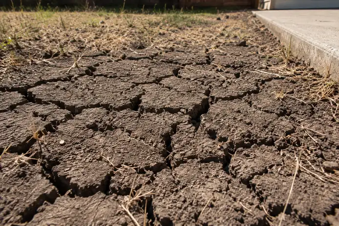
What "Expansive" Means, in One Number
Soil scientists measure swelling with a number called linear extensibility. It's how much a lump of soil changes length between moist and fully dry, written as a percent. The USDA sorts soils into four bands:
- Under 3: low
- 3 to 6: moderate
- 6 to 9: high
- 9 or more: very high
The survey's own note is plain about what that means. Soils rated moderate to very high can damage buildings, roads and other structures as they shrink and swell.
Here's a way to picture it. Take a lump of Houston Black clay that's 10 inches long when it's bone dry. Wet it, and it would stretch to nearly 12 inches. A lump of Eddy soil would hardly change at all. Real ground never dries out as fully as a lab sample, so treat the number as a way to compare soils, not a forecast of how far your house will move.
Garland's Six Main Soils
The USDA soil survey maps the soil across every county. We checked it at 25 points spread evenly across Garland. Six soils came up most often, and they fall into three families: dark clays that formed from shale, thinner soils over chalk, and the ground along the creeks.
The shale clays: Houston Black and Ferris
Houston Black is the classic Blackland Prairie clay, and it's Garland's most common soil, at 32% of our sample points. It reads 17 and runs 55% clay. The survey says it formed from shale and marl, and it gives the same reading of 17 from the surface down to about six and a half feet. There's no calmer layer underneath for a slab to rest on.
Ferris reads the same 17, runs 52.5% clay and covers another 16%. It's mapped on sloping ground, and the survey describes it as eroded, meaning some of its topsoil has washed away over time. Its clay reads 17 down to about three and a half feet, where it gives way to denser, calmer material.
Together, these two clays cover nearly half the city.
The chalk soils: Dalco and Eddy
Dalco reads 7.5. That's still high, but it's less than half the reading of Houston Black. It runs 47.5% clay and covers 12% of our points. Its parent material, per the survey, is Austin Chalk, and soft rock sits about three feet down.
Eddy is the calm one. It reads 1.5, low on the USDA's scale, and covers another 12%. It's a thin soil, about 11 inches of clay loam over soft chalk rock, so there's very little clay there to swell.
That matters if your floors are moving and your house sits on Eddy. Shrink and swell probably isn't the cause, so it's worth looking for a plumbing leak, poor grading or roof water landing in one spot first.
The creek ground: Branyon and Frio
Branyon is the one that hides. Even the top foot reads 9.9, a very high number on its own. Below that it climbs to 13 and stays there past six feet. It runs 53% clay and covers 8% of our points, on old stream terraces in the creek valleys. Digging a flower bed won't show you what the slab is sitting on.
Frio sits lowest, on the flood plains themselves. It reads a moderate 4.5 near the surface and 5.7 deeper down, with 44% clay, and covers another 8%. The survey lists it as frequently flooded. If your lot is mapped on Frio, it's low ground, and drainage is the first thing to look at.
Look Up the Soil Under Your Own Lot
The survey is free and public, and checking your own lot takes about ten minutes.
Open Web Soil Survey. Go to websoilsurvey.nrcs.usda.gov and click "Start Web Soil Survey."
Find your house. On the left, under Quick Navigation, open "Address," type your address and click "View." On a phone standing in your yard, "Latitude and Longitude or Current Location" will use where you are.
Box in your house. With the rectangle tool above the map, drag a small box around your lot. The survey's name for it is your area of interest.
Click the Soil Map tab. Every soil inside your box is listed there by name. Match them to the six above.
Keep two things in mind as you read it. Its maps cover areas, not one lot at a time. In the built-up parts of Garland, it also lists roughly a quarter to a third of each mapped area as "urban land," with no soil readings at all. And before a slab is poured, builders level the lot and pack the soil down, so the top of your yard may not be the ground nature left there.
So the map is a strong clue, not the final word. The USDA itself says some engineering uses need a check on site, and for a single lot, that means a soil test by an engineer.
Why the Same Soil Moves More Under Some Houses
Clay only moves when its moisture changes, and the damage comes from uneven change. If the whole slab rose and fell together, very little would crack. Trouble starts when one side of the house stays wet while the other dries out.
In practice that's nearly always one of three things. Water pools against one side of the house, a big tree draws water from one corner, or a leaking pipe under the slab keeps one patch of clay wet all year.
Timing matters too. Clay shrinks through a dry late summer and swells again with spring rain, which is why so many cracks open in August and close up by April. Our guide to the signs of foundation problems shows how to use that cycle to tell whether a crack is still moving.
What Your Soil Means for Looking After Your House
You can't change the soil, but you can change how its moisture swings. The Post-Tensioning Institute, which publishes the design method used on millions of post-tension house slabs, puts it plainly: how a slab holds up over the years depends on good drainage and on the owner keeping the soil moisture steady.
- On Houston Black, Ferris or Branyon, steady moisture is everything. Keep water moving away from the house, stop downspouts from emptying beside it, and water evenly through a dry summer. That guide also covers downspouts, grading and trees.
- On Dalco, the same advice applies, with a little more room for error.
- On Eddy, look elsewhere first if something moves, starting with a leak or a drainage problem.
- On Frio, start with drainage and how water reaches your lot.
The age of your house changes how it responds to the same ground. A pier and beam house, a rebar slab and a post-tension slab each show trouble in their own way, and our slab vs pier and beam guide explains how to tell which one you have.
If anyone assesses your foundation, it's fair to ask which soil they think it's sitting on. "Expansive clay" is where a good answer starts. Houston Black at 17 and Eddy at 1.5 call for very different conversations.
How Garland Compares With Its Neighbors
Soil changes across city lines too. Here's the main soil at our sample points in each city:
- Garland: Houston Black, 32%, reads 17, with Ferris another 16% at 17
- Mesquite: Houston Black, 32%, reads 17 at half our points and 12 at the rest
- Plano: Houston Black, 64%, mostly reads 12
- Murphy: Houston Black, 60%, mostly reads 12
- Rowlett: Houston Black, 36%, mostly reads 12
- Rockwall: Houston Black, 36%, reads 12
- Sachse: Houston Black, 28%, mostly reads 12
- Sunnyvale: Houston Black and Trinity, 16% each, reading 12 and 13
- Wylie: Heiden, 32%, reads 12.2
- Richardson: Austin, 44%, mostly reads 7.5, with Houston Black on another 36%
- Balch Springs: Rader, 24%, reads 1.5 at the surface and 7.5 below
Houston Black reads 17 on some of the survey's maps and 12 on others, but both readings sit well inside the very high band. The bigger gap is between soils. Plano and Richardson share a border, yet 64% of our Plano points landed on very high clay, against 36% in Richardson, where Austin mostly reads 7.5. That's a big difference in movement, one city line apart. You'll find the full soil breakdown for each city on its own page.
Garland Soil Questions
Does all of Garland sit on expansive clay?
Most of it, but not all. Houston Black and Ferris, both very high, cover nearly half our sample points. Eddy, a thin soil over soft chalk rock that reads just 1.5, turned up at 12%, and Frio along the creeks is only moderate.
How far down does Garland's clay go?
It depends on the soil. Houston Black reads 17 from the surface to about six and a half feet. Ferris stays at 17 to about three and a half feet. Dalco has about three feet of clay over soft rock, and Eddy has less than a foot.
Is there a way to check the soil under my own house?
Yes. The USDA's Web Soil Survey is free: type in your address, draw a box around your lot and open the Soil Map tab. It maps areas rather than single lots, so for one property, a soil test by an engineer is the final word.
If my lot is clay, will my house need foundation repair?
No. Clay sets the stage, but uneven moisture is what moves a house. Steady watering, good drainage and catching leaks early go a long way, even on Houston Black.
Why did my neighbor never have this problem?
It could be different ground. Garland has six common soils, and they can change from one street to the next. Drainage, trees and plumbing leaks explain much of the rest.